
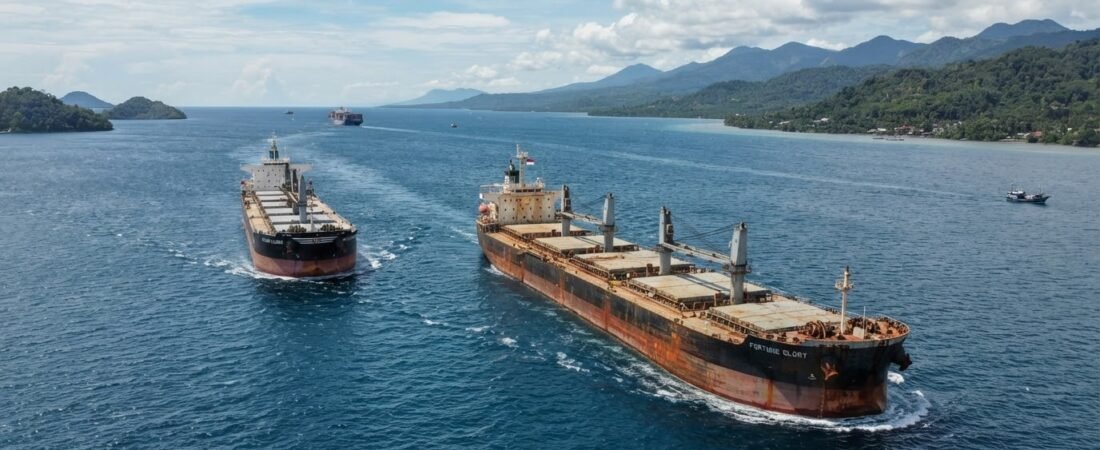
The establishment of Nusantara (Ibu Kota Nusantara or IKN) as Indonesia’s new administrative capital is fundamentally altering the nation’s maritime trade matrix. Positioned directly along the Makassar Strait, Nusantara sits on one of the most strategic, high-capacity deep-water shipping corridors in Southeast Asia: the Archipelagic Sea Lane II (ALKI II). As global supply chains seek efficiency, resilience, and decarbonization, integrating IKN into international shipping routes via the Makassar Strait presents a transformative opportunity for maritime trade across the Indo-Pacific.
For decades, Indonesia’s maritime traffic was heavily skewed toward the Western archipelago, particularly the congested Malacca Strait and the overcrowded ports of Java. The development of IKN acts as a counterweight, decentralizing port traffic and transforming East Kalimantan into a primary maritime gateway. By upgrading regional deep-water ports, integrating smart port technology, and establishing direct feeder lines to Asian trade hubs, Indonesia is positioning Nusantara as a central nexus in global maritime logistics.
1. The Strategic Imperative of the Makassar Strait (ALKI II)
The Makassar Strait serves as the primary artery of Indonesia’s ALKI II corridor, connecting the Celebes Sea in the north to the Java Sea and Lombok Strait in the south. Unlike the Malacca Strait, which suffers from severe physical bottlenecks, shallow draft restrictions, and heavy vessel congestion, the Makassar Strait offers naturally deep waters capable of accommodating fully laden Capesize and Very Large Crude Carrier (VLCC) vessels.
This natural depth makes the Makassar Strait an indispensable alternative for international shipping routes, particularly for trade flows moving between Australia, East Asia (China, Japan, South Korea), and the Americas. By embedding Nusantara’s port infrastructure directly into this oceanic corridor, Indonesia reduces transit times, minimizes transshipment steps, and secures direct access to global supply networks.
Key Nautical Advantages of ALKI II:
- Deep-Water Capacity: Naturally deep channels permit ultra-large container ships and bulk carriers without requiring extensive continuous dredging.
- Strategic Distance Reduction: Provides a direct north-south transit route linking Southern Hemisphere resource exporters to Northern Hemisphere manufacturing hubs.
- Congestion Bypass: Serves as a vital relief valve for the increasingly overcrowded shipping lanes of the Malacca Strait and Singapore Strait.
This article is part of our comprehensive cluster on regional supply chain infrastructure. To understand how IKN reshapes the broader macro-economic landscape, read our hub guide:
Building the Future: How Nusantara Capital Reshapes Regional Supply Chains.
2. Port Modernization: Kariangau and Palaran as Maritime Anchors
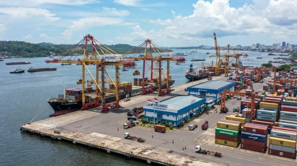
To convert strategic geographic location into tangible supply chain efficiency, Indonesia is accelerating capacity expansions and technological upgrades across East Kalimantan’s core maritime terminals. The two primary anchors driving this transformation are the Kariangau Terminal Logistics (KMT) in Balikpapan and the Palaran Terminal in Samarinda.
Kariangau is being developed into a high-throughput, international-standard container terminal. Located within Balikpapan Bay, Kariangau benefits from sheltered waters and deep drafts suitable for ocean-going container vessels. Modernization efforts focus on expanding quay lengths, installing post-Panamax gantry cranes, and integrating automated container yard operations to drastically improve Container Dwell Time and Gross Crane Moves per Hour (GCMH).
ini
| Port Terminal | Primary Strategic Focus | Key Infrastructure Capabilities |
|---|---|---|
| Kariangau Container Terminal (Balikpapan) | Primary international container gateway & heavy cargo point | Deep-water berth, automated gantry cranes, direct highway access to IKN |
| Palaran Port (Samarinda) | Intra-island feeder hub & bulk river-sea transshipment | Inland waterway integration, coal/resource handling, regional container distribution |
| KIPP Logistics Port (Penajam Paser) | Dedicated construction material & municipal supply terminal | Ro-Ro ramps, heavy-lift berths, high-speed barges to core government zones |
3. Connecting IKN to Global Shipping Lines and Direct Feeder Networks
A critical challenge for new maritime hubs is establishing sufficient cargo volume to attract major liner shipping alliances (such as 2M, Ocean Alliance, and THE Alliance). Traditionally, cargo bound for East Kalimantan required feeder transit via Surabaya (Tanjung Perak) or Jakarta (Tanjung Priok). This multi-stop transshipment added up to 5 to 7 days of transit time and inflated freight costs.
To break this dependency, the Indonesian government and port authorities are introducing targeted incentives for international shipping lines to establish direct calls at Balikpapan. By consolidating regional exports—including palm oil, processed minerals, timber, and agricultural goods—with inbound construction materials and consumer goods for Nusantara, East Kalimantan is generating the necessary two-way cargo density to sustain direct direct-call shipping routes to East Asian feeder hubs like Singapore, Port Klang, and Kaohsiung.
Benefits of Direct Shipping Line Integration:
- Reduced Lead Times: Eliminates extra transshipment stops in Java, saving up to 30% in end-to-end maritime transit duration.
- Lower Freight Tariffs: Eliminates double-handling fees at intermediate domestic ports, lowering overall landed costs for businesses.
- Cold-Chain Expansion: Direct reefers lines enable local seafood and agricultural producers in East Indonesia to export directly to international markets without quality degradation.
4. Digitalization and Smart Port Infrastructure
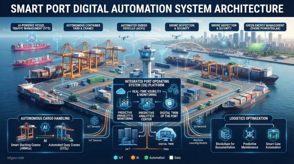
Modern supply chains depend as much on digital throughput as they do on physical infrastructure. Nusantara’s maritime ecosystem is being built around the concept of Smart Ports, fully integrated into Indonesia’s national logistics ecosystem (Inaportnet) and global maritime tracking databases.
Through the deployment of Internet of Things (IoT) sensors, automated customs clearing systems, and AI-driven vessel traffic management, ports in the IKN cluster are reducing administrative delays and eliminating paper-based documentation. Optical Character Recognition (OCR) at gate terminals and digital twin simulation systems allow terminal operators to optimize yard space and predict equipment maintenance, minimizing vessel berth time and carbon emissions from idling ships.
Maritime routes are only one piece of the multimodal puzzle. Explore how air cargo and eco-warehousing support this network:
5. Green Maritime Initiatives and Environmental Protection
Given IKN’s strict commitment to sustainability and its “Forest City” vision, the expansion of maritime traffic along the Makassar Strait must adhere to high environmental standards. The Makassar Strait contains sensitive marine ecosystems, including coastal mangroves and coral reef networks that require rigorous protection from maritime pollution, ballast water discharges, and vessel emissions.
East Kalimantan’s modernized ports are implementing green port frameworks aligned with International Maritime Organization (IMO) decarbonization targets. Key initiatives include:
- Onshore Power Supply (OPS): Providing shore-side electricity to docked vessels, allowing ships to turn off their diesel auxiliary engines while berthed to eliminate localized air pollution.
- LNG and Green Fuel Bunkering: Developing infrastructure for alternative marine fuels, positioning Balikpapan as a regional fueling hub for LNG-powered and methanol-ready vessels operating along ALKI II.
- Mangrove Buffer Zones: Mandatory ecological buffer zones surrounding industrial port land to preserve carbon sinks and protect coastal biodiversity.
6. Strategic Outlook: What This Means for Global Supply Chain Managers
The transformation of the Makassar Strait from a transit channel into an active maritime industrial hub requires supply chain directors and global logistics planners to re-evaluate their Southeast Asian routing strategies.
Companies operating in East Asia, Australia, and ASEAN can now leverage East Kalimantan as a strategic regional redistribution point. By shifting inventory hubs closer to ALKI II, multi-national firms can diversify their trade routes, insulate themselves from disruptions in the Malacca Strait, and gain direct access to the emerging consumer markets of Eastern Indonesia.
Actionable Recommendations for Logistics Executives:
- Re-Route Regional Supply Chains: Audit current shipping lanes into Indonesia to identify opportunities for direct calls to Kariangau/Balikpapan instead of Java transshipments.
- Secure Port-Adjacent Real Estate: Invest early in bonded logistics centers (PLB) near Kariangau Port to secure prime position for distribution activities.
- Align with Green Shipping Standards: Partner with maritime carriers that utilize eco-certified vessels and green port services to satisfy corporate ESG benchmarks.
Conclusion: Anchoring Nusantara in Global Maritime Trade
Connecting Nusantara to global shipping routes via the Makassar Strait is more than an infrastructure build-out; it is a strategic repositioning of Indonesian maritime power. By harnessing the natural advantages of ALKI II, investing in deep-water smart ports, and enforcing green maritime standards, East Kalimantan is emerging as a premier maritime gateway for the Asia-Pacific region.
As Nusantara continues its evolution into a fully operational capital, its maritime connectivity will serve as the primary engine driving economic integration, trade resilience, and sustainable growth across East Indonesia and beyond.